On their website, Wasco County maintains an interactive map that shows a variety of information about the county, including tax lot and zoning information – along with a lot more.
If you’re not familiar with GIS (Geographical Information Services) the Wasco County GIS department’s main page will help you understand: It’s a way of tying data to locations in a map interface.
Once you’re familiar with GIS and how to use it, skip right to the GIS tool (or click on either the Web Map link or the image in the GIS department page).
How to Use the GIS Map
When the Disclaimer message pops up, click the “I agree” box in the lower left, then hit the Accept button to the right.
If you’d rather read instructions on how to use this map, see below. If you’d rather watch a video, Wasco County has one.
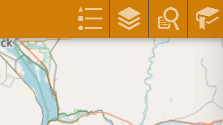
There are tools in the upper left and the upper right.
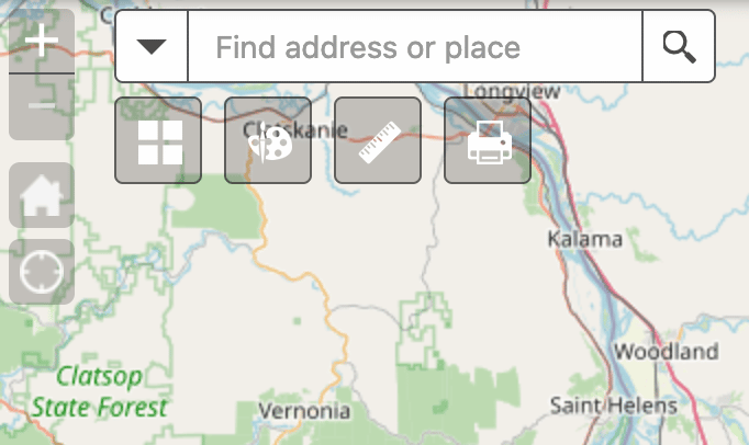
You’ll have to zoom in to see Mosier properties. You can do this with the + and - buttons in the upper left, or by using your scroll wheel (you may have to hit the Shift key too). You can also move the map around in your browser by clicking, holding, and dragging.
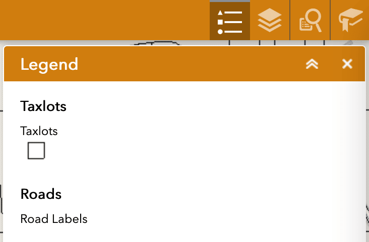
Once you’ve zoomed in to Mosier, by default you’ll see black borders around each tax lot. If you want to know what the colored lines mean, turn on the legend by clicking on the button in the upper right that looks like three lines.
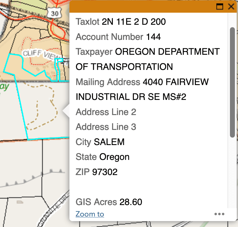
Click on a lot to see basic info like the taxpayer’s address and the acreage.
To see additional information on the map, click the layer button in the upper right. You’ll see a list of options you can turn on and off, like zoning, geologic information, and soil type.
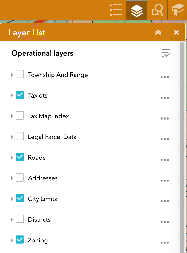
Once you add a new layer, you’ll want to switch back to the Legend to see what it all refers to. Play around – you can draw on the map, add text, and print the results.
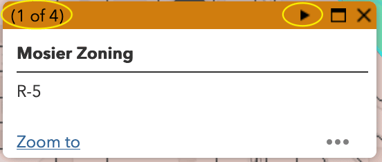
Some layers, but not all, will add a tab to the popup tax lot info box. In this case, the box will tell you how many tabs there are in the upper left, e.g. “1 of 4”, and will give you an arrow button to click to move between tabs.
What Do Zoning Codes Mean?
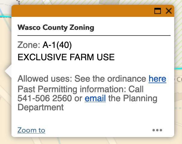
When you look up zoning codes, you’ll just get the property’s official code, like C or R-5. To see what a zoning code means, note in the lot’s info box whether it’s Mosier Zoning or not.
For Mosier zones, see Section 15.02 of the City’s Municipal Code. NSA (National Scenic Area) and Wasco County zoning should give you a link to look up the code – follow the ‘here’ link in “See the ordinance here,” as shown below.