Mosier is a popular destination for a variety of outdoor activities – especially hiking and biking trails – many of which you can get to from the center of town. Free day use parking is available in several places, marked on the map below. See our Parks page for places you might want to check out while you’re biking and hiking in Mosier.

Bike Riding
Distances and elevation gains are approximate, and assume you start from Totem Plaza in downtown Mosier (which is about 110′ elevation).
Bike Hub
In the wedge of land between Route 30, 2nd Ave., and Idaho St. is a resource hub for biking in the Mosier area.
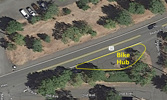
The hub offers bike lock racks, a tire pump, a picnic bench, and a variety of maps showing what the Mosier area has to offer – including a map of the Mosier Plateau Trail, maps of places to visit in and around Mosier, and more.
Twin Tunnels to Hood River
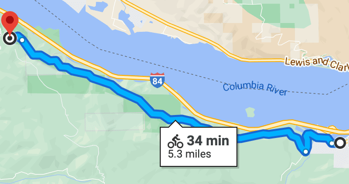
The “Twin Tunnels” is the local name for the segment of the Historic Columbia River Highway State Trail between the Mark O. Hatfield West Trailhead in Hood River and the corresponding East Trailhead in Mosier. This trail is part of the Gorge Towns to Trails initiative.
This popular bike and hiking route, 11 miles round trip, gains about 420′ elevation gain as it wends its way above the Columbia River between the two towns. There are several viewpoints and picnic benches and a waterfall or two.
Note that while there is a parking lot at the start of the trail, only parking for disabled vehicles is allowed; the official trail and parking lot are a bit further up the road.
Sevenmile Hill
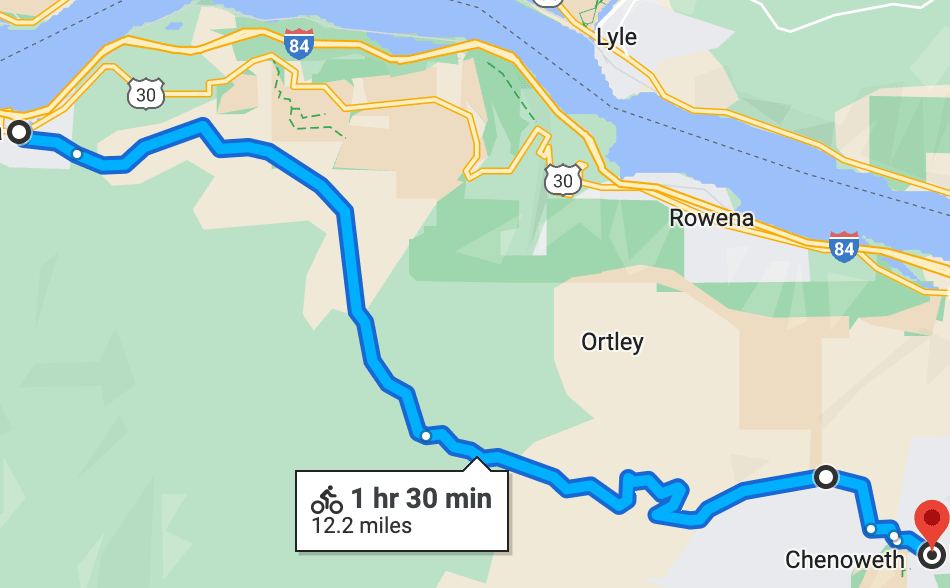
A beautiful 12 mile (one way) ride up one side of Mosier Creek Valley, into the hills above The Dalles – a 1650′ elevation gain, and down to the west end of The Dalles.
Fun fact: geologically, those hills are called the Rowena basalts, part of the Ortley Anticline a.k.a. the Columbia Hills Uplift, which forms the western end of a series of ridges and valleys known as the Yakima Fold Belt that covers much of central and eastern Washington and Oregon. During the Missoula floods, vast flows of water carved right through the Ortley Anticline, leaving us with the remarkable basalt cliffs along this stretch of the Columbia River.
Come back the same way for a real workout, or take Route 30 back (see below for more on that).
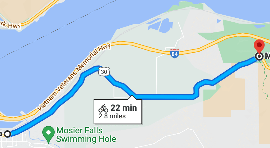
Memaloose Overlook
This short out-and-back route goes up the Historic Columbia River Highway to Memaloose Overlook and back, a 5.5 mile round trip with an elevation gain of 415′.
Marsh Cutoff
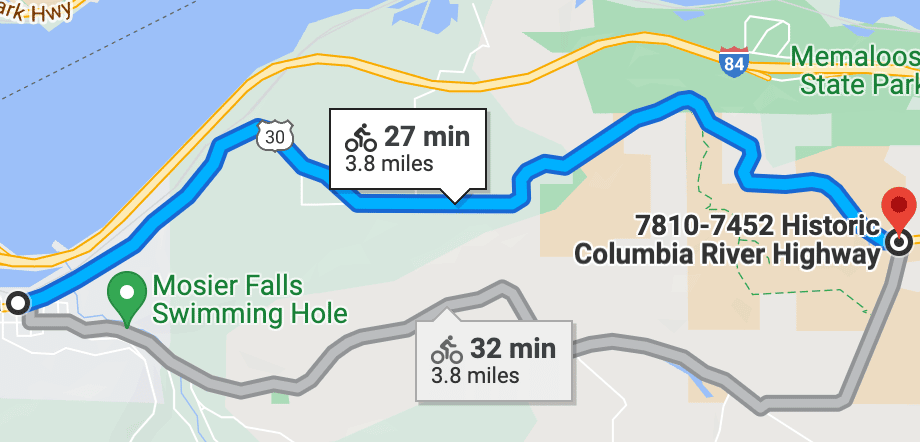
This loop takes you through the hills and plateaus east of Mosier, up Route 30 past Memaloose Overlook to Marsh Cutoff Rd. to State Rd. and back to town, 7.5 miles total with an elevation gain of 610′.
Rowena Crest Viewpoint
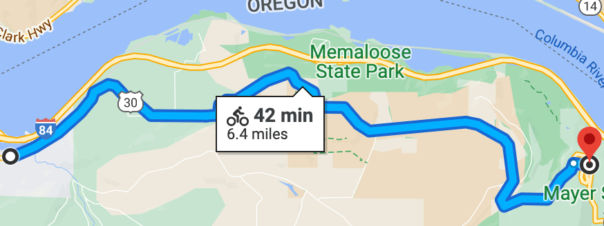
This route can be done as an out-and-back, up Route 30 past Memaloose Overlook to scenic Rowena Crest Viewpoint in the Tom McCall Nature Preserve and back, a 13 mile round trip with an elevation gain of 650′.
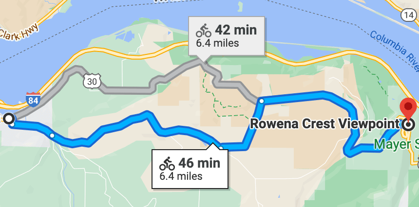
Or come back via Marsh Cutoff Rd. for a view of Mosier Valley.
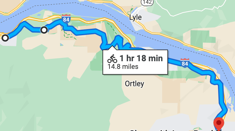
Route 30 to The Dalles
A 15 mile one-way ride along the Historic Columbia River Highway, up to scenic Rowena Crest Viewpoint in the Tom McCall Nature Preserve – a 625′ elevation gain, back down to river level, on to the very west end of The Dalles.
Hiking & Walking
There are several walks and hikes around Mosier.
Twin Tunnels to Hood River
The Twin Tunnels is our local name for the popular segment of the Historic Columbia River Highway State Trail between the Mark O. Hatfield West Trailhead in Hood River and the Mark O. Hatfield East Trailhead in Mosier. This trail is part of the Gorge Towns to Trails initiative.
This popular bike and hiking route, 11 miles round trip, gains at most about 420′ elevation as it wends its way above the Columbia River between the two towns. There are several picnic tables along the way, so if you want to pack a lunch and break up the walk, you can!
Note that at the start of the trail, only parking for disabled vehicles is allowed; the official trail and parking lot are a bit further up the road.
In the wake of the Microwave Tower Fire in July, 2024, much of the land along the trail is closed till further notice.
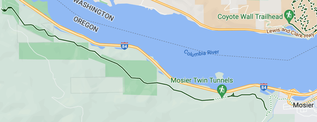
See a more detailed map.
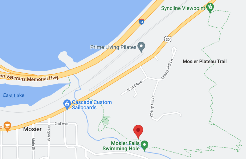
Mosier Plateau Trail
Mosier Plateau is a relatively flat area east of the town of Mosier, marked on the west by bluffs above Mosier. This plateau is part of the Mosier Syncline, the geological feature that describes the way the layers of rock tilt toward each other in this stretch of the Columbia River.
The western part of the plateau is a 45-acre nature preserve which is home to oak woodlands and a diverse array of wildflowers that bloom in stunning color each spring.
The Mosier Plateau Trail is part of the Gorge Towns to Trails initiative, and runs up along Mosier Creek, then zig zags up a steep hill to a viewpoint on the bluffs, overlooking Mosier Valley, the town itself, and the Columbia River on the west to Bingen, White Salmon, Underwood Mountain, and Dog Mountain, and on the east to the town of Lyle, Washington.
You can hike 1.4 miles for an up-and-and-back trip to the viewpoint above Mosier, or continue down the north side of the trail for a 2.7 mile full loop, a ~450′ elevation gain either way.
Along the way you’ll pass through Pocket Park, where you’ll see the Pioneer Cemetery and Mosier Creek Falls, with its little swimming hole.
Please always stay on the trail and clean your boots before and after you hike. Hikers are a common vector for spreading invasive seeds.
Waterfront and lake trail
An easy 2 mile loop, this mostly flat trail starts at Rock Creek Park, takes you along the Columbia River to the mouth of Mosier Creek, back inland along the south side of East Lake, and back to Rock Creek Park.
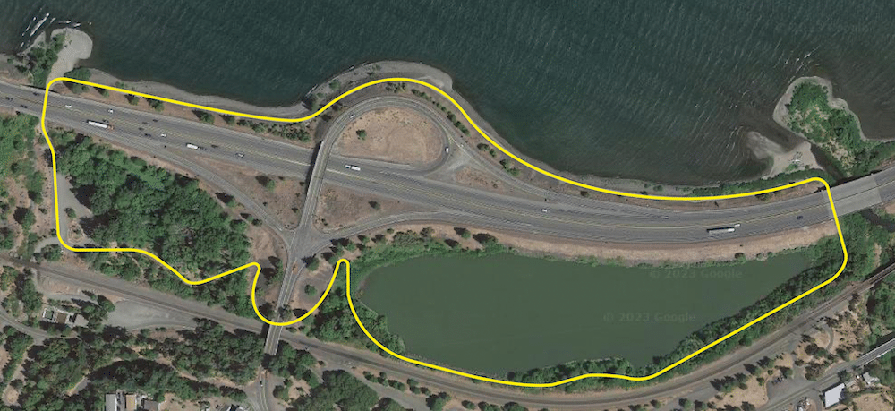
Note that in winter and spring, parts of the trail along the lake may be flooded; in spring, vegetation may grow out into the trail depending on when maintenance occurs. Some portions are rocky.
You can also start from Totem Plaza, which adds half a mile each way.
If you want to start at Rock Creek, note that parking in the park itself requires a $5 day pass or a $30 seasonal pass, available at Mosier Market at 1010 1st Ave., just across from Totem Plaza. Parking is free outside the park entrance, along Rock Creek Rd.
